CNR-ISAC Weather Forecasts
GLOBO - BOLAM - MOLOCH models
CNR-ISAC, Bologna
 |
 |
 |
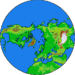
| GLOBO, 19 km, 7 days Globo model 7-day forecast maps |
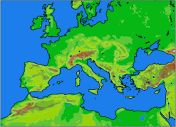
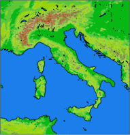
BOLAM, 8.3 km, 3 days Bolam model 3-day forecast maps | MOLOCH, 1.25 km, 2 days Moloch model 2-day forecast maps |
DESCRIPTION:
As part of the activity of the research area CAMEO, researchers at ISAC have developed in the course of the years several numerical models for the study of atmospheric circulation and composition, with the primary purpose of studying the physical mechanisms that regulate them. We are involved in the forecast of meteorological conditions, transport of pollutants and air quality, both as a testbed of our understanding and for its relevance for society at large.
The forecasting suite presented in these pages is used for real-time weather forecast, including a monthly ensemble forecast, as part of an agreement with the National Civil Protection Department (DPCN). The ensemble probabilistic monthly prediction is entered in the database of the WWRP/THORPEX-WCRP joint project Sub-seasonal to Seasonal Prediction (S2S).
From the buttons above, the following forecasts can be accessed:
- a monthly ensemble forecast (GLOBO model);
- a 7-day global forecast (GLOBO model);
- a 3-day forecast on the European-Mediterranean area (BOLAM model);
- a 2-day high-resolution forecast over Italy (MOLOCH model).
All times are given as UTC, local time for Italy is UTC+1 (winter) or UTC+2 (summer).
The global model GLOBO is run for seven days ahead from the 00 UTC analysis of the GFS model of NOAA-NCEP. The GFS analysis is also used as initial condition, and the GLOBO forecasts as boundary conditions, for a 72 hours forecast on the Euro-Mediterranean area with the BOLAM model. Finally a 45 hours run of the non-hydrostatic model MOLOCH, nested in BOLAM, is done over Italy alone.
The Sea Surface Temperature (SST) field over the Mediterranean Sea, the Black Sea and part of the Atlantic is provided daily from Copernicus Marine Environment Monitoring Service (CMEMS) and adapted by the CNR-ISMAR Institute in Rome for input to the BOLAM model.
WARNINGS:
Be aware that: 1) The skill of the forecasts degrades with increasing lead time 2) Near-surface fields (2m temp and 10m wind) suffer from low-resolution orography and imperfect representation of fog.
DISCLAIMER
ISAC is providing this data "as is", and ISAC cannot be held responsible, nor assume any liability for any damages caused by inaccuracies in this data or documentation, or as a result of the failure of the data or software to function in a particular manner. ISAC makes no warranty, expressed or implied, as to the accuracy, completeness, or utility of this information, nor does the fact of distribution constitute a warranty. Data have not been subjected to quality control or quality assurance procedures.
| Products for DPCForecast charts for operational meteorological prediction at the National Department of Civil Protection |
Contact: dinamica-at-isac.cnr.it (replace -at- with @)

This work by CNR-ISAC is licensed under a Creative Commons Attribution-NonCommercial-NoDerivs 3.0 Unported License.