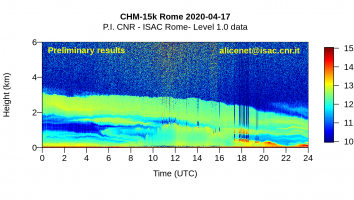
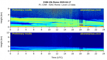
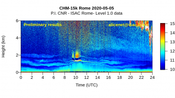
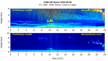
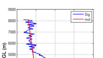
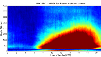
The Lidar-Ceilometer is an active remote sensing sensor that uses laser pulses backscattered from the atmosphere to determine cloud height and vertical aerosol distribution with altitude. It has been installed at CIRAS since 2012.
Measured quantities: vertical distribution of particulate matter with high vertical and temporal resolution from which the mixing layer height (MLH) and the cloud base are determined, as well as, the presence and vertical extension of desert dust, fire plume or volcanic eruptions are identified; mists, fine clouds.
Applications: Studies on air quality, radiation, climate.
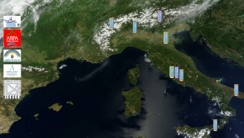
Networking: the Lidar-Ceilometer is part of a national network of stations (ALICEnet www.alice-net.eu) coordinated by ISAC. ALICEnet networks operational observations carried out by Italian Research Institutions and Environmental Agencies in order to contribute to the synergic use of environmental data of multidisciplinary interest. ALICEnet is the only Italian network that contributes to the European E-PROFILE network of EUMETNET