Earth Observation (EO) technology is used to contribute to a better physical understanding of the interactions and feedbacks between atmospheric processes both in the upper and lower part of the troposphere and at the air/soil interface. The EO activity is carried out within four main directions:
- Development and integration of observational technologies and methodologies (from satellite and ground-based) for monitoring clouds, precipitation, wind and radiation, for the study of phenomena and processes related to the hydrological cycle, and for the characterization and monitoring of extreme events in the Mediterranean basin;
- Use of long-term observational datasets and integration of observational techniques for the monitoring of essential climate and environmental variables in strategic and vulnerable regions (including polar and mountain areas and other climatic hotspots);
- Integration of observational and modeling techniques for the study of turbulent and dispersive dynamics of the atmospheric boundary layer and for the evaluation of its influence on meteorology and climate in different hotspot areas (polar areas, urban areas);
- Use of satellite data for the analysis of air-sea interaction processes in the Mediterranean and their effects on extreme events
Specific activities
1) Clouds and Precipitation Physics
- Radar meteorology and disdrometers
- Quantitative precipitation estimation
- Cloud and precipitation microphysics from ground-based and space-borne radars (dual polarization, Doppler, multiple frequency measurements, profilers)
- Microphysical properties for liquid and solid precipitation particles
- Satellite meteorology
- Remote sensing of clouds and precipitation
- Development of precipitation retrieval algorithms and operational precipitation products (snowfall, rainfall, hail) based on microwave sensors on board LEO satellites and GEO VIS/IR observations
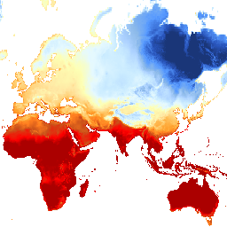
- Long-term, satellite-based regional and global climatology of cloud and precipitation (variability and trend analysis, and teleconnections)
- GNSS meteorology
- Atmospheric Electricity
- Ground- and space-based real-time lightning detection
- Study of electrical charges in the Earth's atmosphere
- Cloud electrification mechanisms and lightning discharge processes
- Ground-, airborne-, and satellite-based studies of terrestrial gamma-ray flashes (TGF)
- Study of Transient Luminous Events (TLE)
- Multisensor techniques (satellite- and ground-based)
- Characterization and monitoring of extreme atmospheric events with a particular focus on the Mediterranean basin (mesoscale convective systems, supercells, Medicanes)
- Orographic clouds and precipitation
- Cloud and precipitation microphysics and formation mechanisms;
- Study of processes in polar troposphere and stratosphere using passive and active ground-based and satellite-based remote sensing and in situ observations;
2) Nowcasting and data assimilation techniques
- Development of observation-based nowcasting tools
- Development of data assimilation techniques of non-conventional observations (lightning, GPS-ZTD and radar-derived quantities)
3) Photometry and solar radiation
- Quality assurance and traceability studies, “on site” calibration procedures
- Satellite-based and ground-based estimates and forecasts of solar radiation fluxes
4) Planetary boundary layer (PBL):
- Observations and study of PBL dynamics
- Use of in situ and remote sensing observations for PBL turbulence and structure, aerosol-climate feedbacks mechanisms, with focus on climate hotspots (polar regions and urban areas)
- PBL properties, micro-meteorological variables, and urban heat islands
- Experimental studies of the stable boundary layer with in situ and acoustic ground-based remote sensing measurements with a focus on the interaction between sub-meso motions and turbulence
- Vertical wind profiles (LIDAR) for wind energy and boundary layer applications
For remote sensing and in-situ facilities and instruments please visit Measurements Hub
Main Projects: EUMETSAT H SAF, ESA RAINCAST, Copernicus C3S_312b_Lot1, ASI GAMMA-FLASH, PNRA, RAMSES, HYMEX, PON OT4CLIMA, Life ASTI, European Skynet Radiometers Network, RAMSES, DPC-ISAC Intesa Operativa
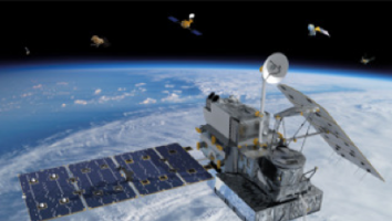
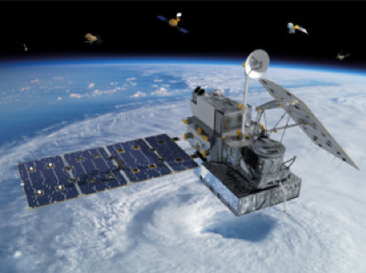
International partnerships: WMO Global Energy and Water Exchanges Project (GEWEX), European and international Space Agencies (CONAE, ESA, EUMETSAT, JAXA, NASA, NOAA), the EU Copernicus program, satellite missions for clouds and precipitation (e.g., ESA/JAXA EarthCare, ESA/EUMETSAT EPS-SG and MTG, and the NASA/JAXA Global Precipitation Measurement (GPM) mission).